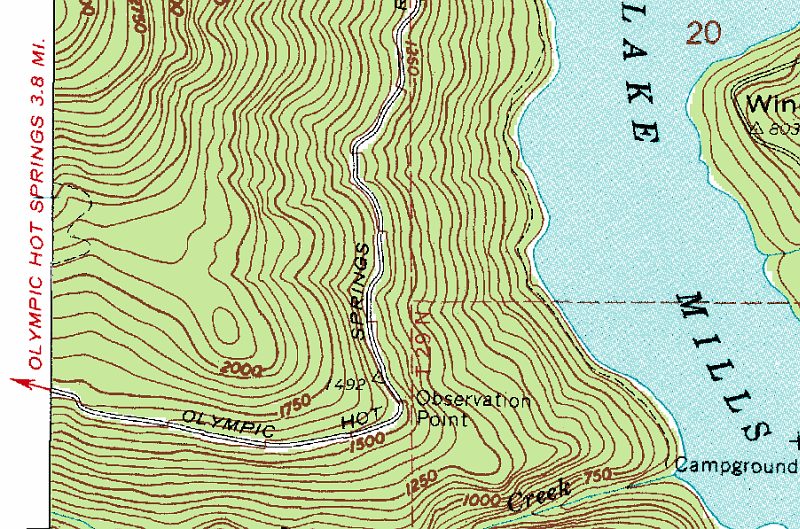
Portion of USGS [[Hurricane Hill Quadrangle]] topo map, ca 1950, showing [[Olympic Hotspring Road]] beginning to climb [[Happy Lake Ridge]] . [[Boulder Creek]] at the bottom; Campground at mouth of creek long gone; Lake recently drained; and [[Olympic Hotsprings Resort]] closed and (not quite) gone. Across the recently exposed [[Elwha River]] valley (former Lake Mills) is the toe of [[Hurricane Hill]].